From Rimini to Ponte Verucchio
Pedestrian and cycle path, right bank of the Marecchia river
This route is taken from the guide "Paths" Rimini routes between nature and history, published in 2009 by the Province of Rimini, Department of the Environment and Policies for Sustainable Development.
Along the way there are CAI (Italian Alpine Club) signs with no. 017. - Length of the route 20.6 km
The route follows the course of the pedestrian and cycle path that leads from Rimini to Ponte Verucchio, an itinerary that is very popular with walkers, hikers and cyclists.
We recommend that you take some good binoculars along with you so as to make the most of the opportunities for observing the avian fauna which is very rich in the Marecchia. The Marecchia floodplain in the stretch from San Martino dei Mulini to Ponte Verucchio, with the adjacent Oasis of Torriana and Montebello, has been recognized as a SCI (Site of Community Importance) due to its environmental value. Overall, the river and hill SCI extends for 2,232 hectares. SCIs are areas intended for the conservation or restoration of natural habitats and wild species and are part of a network of protected areas (Natura 2000 Network) aimed at safeguarding the biodiversity of European biogeographical regions.
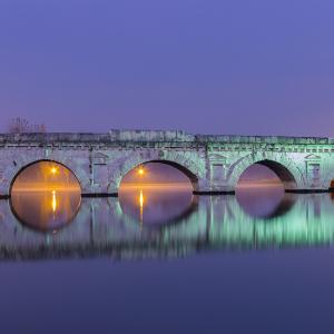
- We start out from Parco XXV Aprile, also known as the Marecchia Park. At the end of the park is the Tiberius Bridge. Going through the park, you skirt the two football fields and arrive on the bank of the Ausa stream.
- The deviating channel of the Ausa blocks the passage so you have to go down and then up the concrete walls or use the nearby pedestrian bridge. From here you get back on the trail again and cross the spans of the state road. The stretch of road up to the Rimini treatment plant, on the left, is a built-up area.
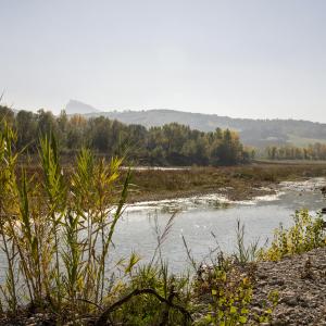
The shore vegetation at this point resumes its intensity and density, with marshy riverbed formations, humid lowlands, shore thickets. In this stretch it is common to come across the typical fauna linked to humid environments, both during the migrating period and in the reproductive phase, in particular the large waders such as gray herons, the white egrets, night herons, little bitterns and even the rarest white heron. These beautiful animals can be spotted along the entire route, at rest in or near the heronries. After that, the trail passes alongside an old Rimini landfill, marked by a hill covered with vegetation, and the military area of Spadarolo.
- Beyond the motorway bridge, you cross the Rio Mavone, which here enters the Marecchia, and the shooting range. Then you will come across the runway for model aircraft.
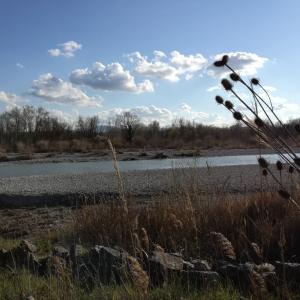
A long stretch follows where the elements of nature seem to regain the upper hand. The environments with the greatest amount of nature are represented by wooded areas, bushes, arid meadows. To these are added the shoreline environments in the strictest sense, represented by loose chippings and semi-stable gravels, colonized by a specific flora. Various species of amphibians, reptiles and micro-mammals characterize this section, like most of the entire zone. Among the vegetation there are roe deer, badgers and porcupines, whose quills can often be found.
- Traveling the following section allows you to reach the ruins of an old bridge over the Marecchia River. After a short distance you will arrive at Lake Santarini. Near a sharp bend, it is possible to get to a viewpoint over the river which can be reached by following the path to the right. It is located opposite the entrance to the Marecchia public park, near the Villa Verucchio (Molino di Terrarossa locality).
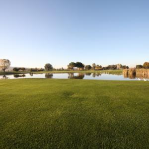
- Continuing along the trail between the canal and the cultivated fields, you reach the golf courses (Rimini - Verucchio Golf Club).
- Follow the trail for a long stretch, then keep going on until you reach the scenic point of the gorges carved by the Marecchia river. Proceed past the Tenuta Amalia in Villa Verucchio on the left, before arriving at the Marecchia park.
- You walk through the park along its edge for the whole length, then on ahead and pass in succession on the left the deviations that connect to the SP 258 road, (you go past a CAI (Italian Alpine Club) arrow on the left towards Pieve)
- Continue on until you turn left, after a short uphill stretch, and you reach the old via Marecchiese.
Here the pedestrian cycle path ends on the right bank of the Marecchia River. (For the return trip, you can reach the nearby town of Ponte Verucchio and use the public transportation).


